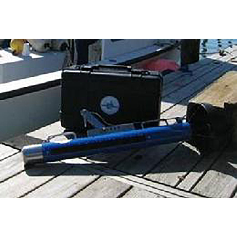
• Skip to primary navigation
  • Skip to main content
  • Skip to footer
  • Home
  • About Terramar
  • News
  • Support
  • Contact Us
Terramar Instruments

Terramar Instruments

Geophysical Equipment Sales and Rental

Geophysical Equipment Supplier
rentals@terramarinstruments.com | 317-993-7815
  • Equipment for Rent
  • Equipment for Sale
  • Manufacturers
    • Dualem
    • Falmouth Scientific
    • Hemisphere GPS
    • Impulse Radar
    • Leica Geosystems
    • Piletest Inc.
    • ZH Instruments
  • Request a Quote
  • About Terramar
  • Support
  • Contact Us
HMS-1400 | Portable Sidescan Sonar System

HMS-1400 | Portable Sidescan Sonar System

Portable digital sidescan towfish and Sonar interface with true 16-bit processing,  Toughbox workstation, and GeoDAS software for high-resolution survey imaging.

Easy-to-use and low-cost, the HMS-1400 System provides single- or dual-frequency operation with depth, heading, and attitude sensors. The powerful GeoDAS software offers an extensive suite of capabilities common in more expensive systems, including display of real-time mosaicing of sidescan images on top of nautical chart data for effective image location, mission execution, survey planning, and advanced target analysis.

Request a Purchase Quote
Category: Marine Seismic Systems Tags: Purchase New, Rental Brand: Falmouth Scientific FSI
  • Description

Description

Features/Benefits

  • Single- or dual-frequency towed sonar sensor
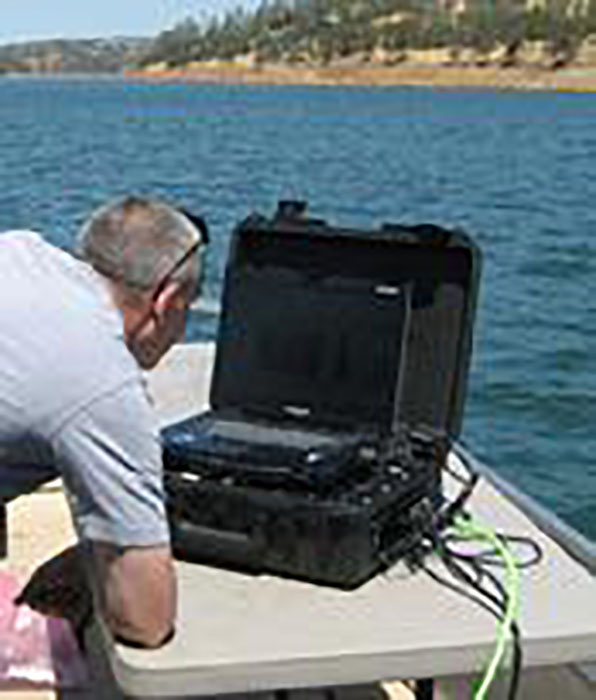
  • Easily transported,interfaced, and deployed
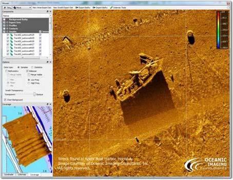
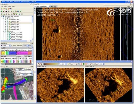
  • True 16-bit processing provides high resolution images of bottomfeatures
  • Powered by GeoDAS software by Oceanic Imaging Consultants (OIC):
    • Automatic bottom tracking
    • Automated processing/contrast enhancement
    • Advanced target analysis/databasing
    • Supports common navigation chart formats – BSB, DNC, S-57
    • Extensive planning, management, and execution tools
    • Real-time mosaicing with easy export to GIS and Google-Earth
    • Compatible with OIC CleanSweep and HarborScan software packages
    • Ideal for port-security/changedetection work.
    • Optional support for XTF data format.

Application Info:

  • HMS-1400 Brochure
  • Product Brief – HMS-1400 for Search & Recover
  • Product Brief – HMS-1400 Helps Local Harbormaster
  • HMS-1400 Data Examples

Related products

  • S321 GNSS Survey Smart Antenna

    S321 GNSS Survey Smart Antenna

    Read more
  • promis

    Promis 10

    Read more
  • Syscal R1 Plus

    Syscal R1 Plus

    Read more
  • DUALEM-4

    DUALEM-4

    Read more

Footer

Terramar Instruments

rentals@terramarinstruments.com
317-993-7815

Contact Us

shipping address:
Terramar Instruments
4920 E23rd Street, Suite B
Indianapolis, IN 46218 USA

mailing address:
Terramar Instruments
4920 E23rd Street, Suite B
Indianapolis, IN 46218 USA

Quick Links

  • Rentals
  • Equipment for Sale
  • Manufacturers
  • Request a Quote
  • About Terramar
  • Support
  • Contact Us

Product Categories

  • Electrical Resistivity Imaging
  • Electromagnetics Systems
  • GPS
  • Ground Penetrating Radar
  • LiDAR
  • Magnetic Susceptibility Meters
  • Marine Seismic Systems
  • Non-Destructive Testing
  • Seismic Refraction and Reflection

Copyright © 2023 Terramar Instruments. All Rights Reserved.